Many landowners in Trinidad believe that once they own a parcel of land, they can immediately start building. In reality, several hidden issues can prevent you from getting approval from the Town and Country Planning Division or other authorities. Knowing these problems early can save months of delays and significant expense.
1. No Legal Road Access
One of the most common issues is landlocked property. Planning authorities normally require that land has legal road frontage or an approved right-of-way. Without this, it can be difficult to approve a building because:
- emergency services must be able to access the property
- utilities must reach the site
- proper traffic access must exist
Sometimes a registered right-of-way across neighboring land can solve the problem.
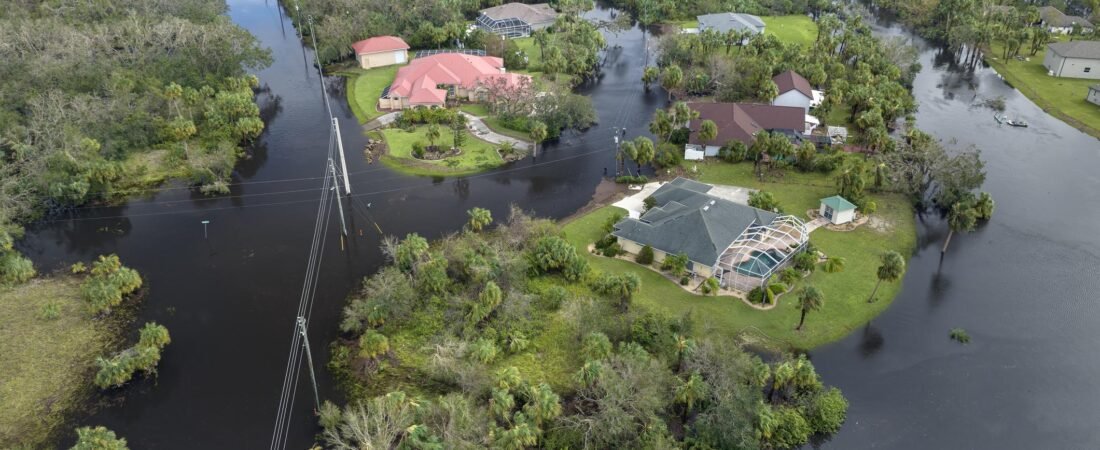
2. Poor Drainage or Flood Risk
Some parcels are located in areas that flood or have poor drainage. Authorities may refuse building permission if the land: lies in a floodplain, blocks natural drainage channels, and lacks proper stormwater management. Developers may need to install drainage systems, culverts, or raised foundations before approval is granted.
3. Agricultural Zoning Restrictions
Some land in Trinidad is zoned primarily for agriculture. If land falls within agricultural zoning, there may be limits on: number of houses allowed, density of development, and commercial activities. Changing the land use may require special approval from the Town and Country Planning Division.
4. Environmental Restrictions
Some properties are located near sensitive environmental areas such as: rivers and watercourses, wetlands or mangroves, forests and coastal zones. In these cases, the Environmental Management Authority may require environmental approval or studies before development.
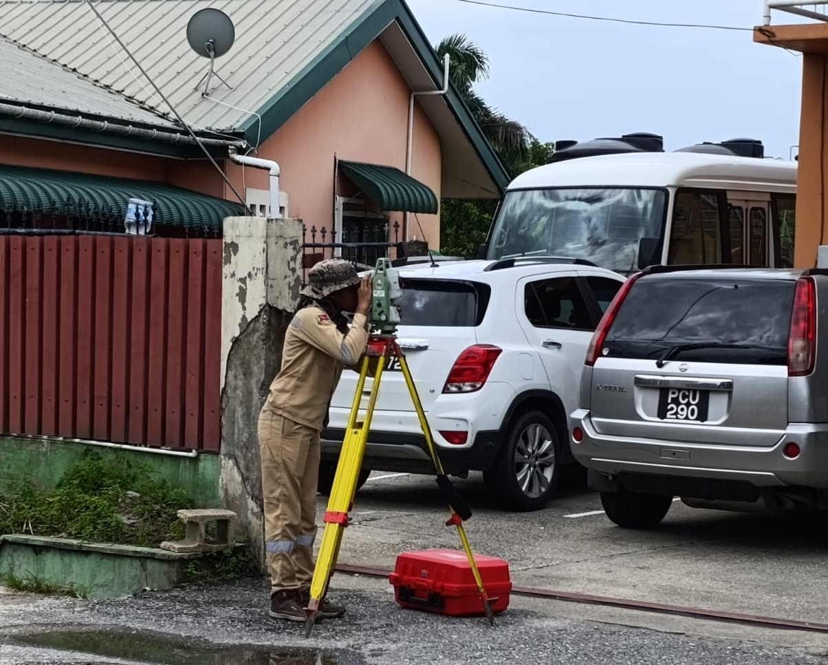
5. Incorrect or Outdated Survey Plans
Planning authorities often require a recent and accurate survey plan. Problems arise when: the survey is outdated, boundary markers are missing, and the plan does not match the actual land on the ground. A licensed surveyor may need to re-establish the boundaries before approval can proceed.
Practical Tip for Landowners
Before applying to build in Trinidad and Tobago, it is wise to confirm:
✔ the land has legal road access
✔ drainage and flooding risks are understood
✔ zoning allows your intended development
✔ environmental restrictions are checked
✔ your survey plan is accurate and up to date
Addressing these issues early can prevent long delays in the planning process.
💡 One important insight:
Many building projects in Trinidad are delayed not because of construction problems, but because these hidden land issues are discovered after plans have already been prepared.
MORE ARTICLES
-
How Long Does a Survey Typically Take?
How long a survey takes depends mainly on what is being surveyed, the size of the land, and the type of survey required. But I’ll give you realistic ranges so you know what to expect. 1. Boundary Survey (Most Common for Property) Typical time on site:⏱ 1–4 hours for a normal residential lot. Total time…
-
What Information Do I Need to Provide for a Successful Land Survey?

When embarking on a land survey, providing the right information is crucial to ensure accuracy and efficiency. Whether you are a property owner preparing for a new construction project, a developer planning a subdivision, or a buyer assessing a potential investment, the success of the survey hinges on the details you supply. A well-executed land…
-
Land for Sale – Prime Residential Parcel
Note: This is a sample land sale advertisement template. Location – e.g., Santa Cruz, Trinidad Property Overview A well-positioned parcel of land located in [community/location], offering excellent potential for residential or investment development. The property has been professionally surveyed, providing clear boundary information and accurate measurements for prospective buyers. This parcel presents an ideal opportunity…
-
What is Cadastral Surveying and How Can It Benefit My Property?
This article delves into the foundational principles of cadastral surveying, highlighting its significance for property owners and developers, and exploring the myriad benefits it can provide. By illuminating the essential role of cadastral surveys, we aim to equip readers with the knowledge necessary to maximize the value and potential of their properties. What is Cadastral…
-
Why Advertising Your Land or Building on ARA Land Services Website is a Good Idea
Selling land or property is not just about putting up a listing—it’s about getting the right information in front of the right buyers. This website provides a specialized platform where buyers, developers, and investors actively look for accurate property data before making decisions. If you want to attract serious buyers and present your property professionally,…