
If you’re planning to build in Trinidad and Tobago, understanding the approval process before construction begins is extremely important. Many projects get delayed because owners start designing or building before completing the necessary steps.
Below is the typical step-by-step process from buying land to getting permission to build.
1. Verify Ownership and Land Title
Before anything else, confirm that the land has clear legal ownership. Important checks include:
- verifying the deed or certificate of title
- confirming the parcel description matches the land
- checking for easements or rights-of-way
This step is often handled with the help of a lawyer.
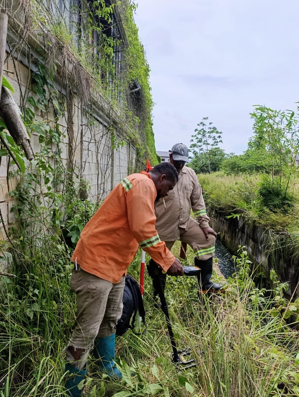
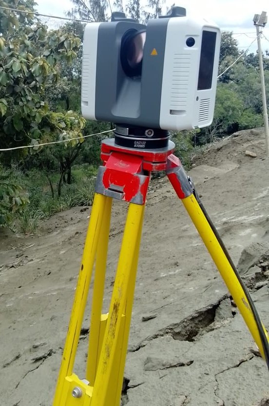
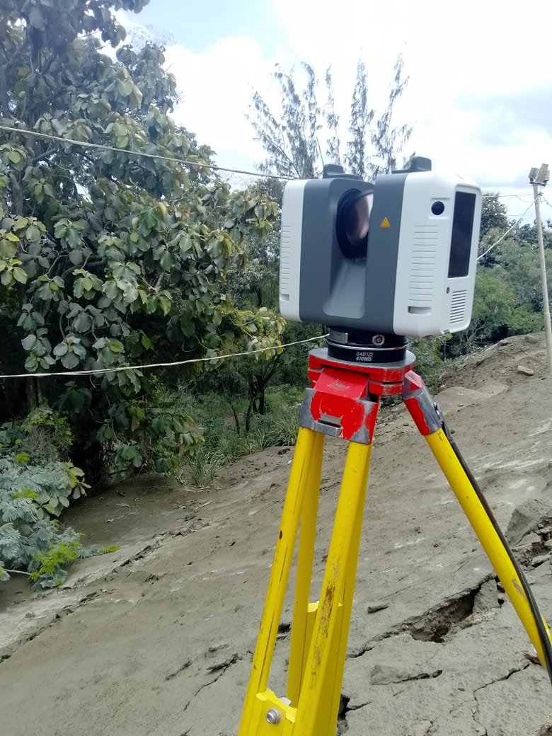
2. Obtain or Verify a Survey Plan
A licensed land surveyor prepares or verifies the cadastral survey of the property. The survey plan will show: property boundaries, dimensions and area, neighboring parcels, and road access. This plan is usually required for planning approval and building design.
3. Check Zoning and Planning Restrictions
Before designing a building, verify zoning regulations with the Town and Country Planning Division. This determines: whether the land is residential, agricultural, or commercial, allowable building height and density, and required building setbacks. Confirming this early prevents designing a building that cannot be approved.
4. Prepare Architectural and Engineering Plans
Once zoning and boundaries are confirmed, professionals prepare:
- architectural drawings
- structural engineering plans
- site layout plans
- drainage designs
These plans must comply with local building regulations.
5. Apply for Planning Permission
Plans are submitted to the Town and Country Planning Division. They review: zoning compliance, site access, drainage impact, and neighborhood compatibility. If the development is large or environmentally sensitive, the Environmental Management Authority may require environmental approval.
6. Obtain Local Building Approvals
After planning permission, additional approvals may be required from the local municipal corporation. They may review: structural safety, sanitation and drainage systems, water and utility connections, and Inspections may occur during construction.
7. Begin Construction
Once approvals are granted, construction can begin.Bef ore building starts, a surveyor may also perform a construction layout survey, marking: building corners, foundation positions, and setback lines. This ensures the structure is built in the correct location.
Typical Timeline (Approximate)
| Step | Estimated Time |
|---|---|
| Title verification | 1–2 weeks |
| Survey plan preparation | 1–2 weeks |
| Architectural design | 2–4 weeks |
| Planning approval | 2–6 months |
| Building approvals | 2–4 weeks |
Planning approval is usually the longest stage.
Practical Advice
Before investing in building plans, it is wise to confirm:
✔ road access exists
✔ drainage is adequate
✔ zoning allows the development
✔ the survey plan is accurate
✔ planning permission is likely to be granted
Doing these checks early can prevent costly redesigns or project delays.
💡 One key insight many people overlook:
The most successful building projects start with good site information—accurate surveys, zoning checks, and planning approval—before any construction begins.
MORE ARTICLES
-
Three Surveying Mistakes That Regularly Cause Project Delays

If you’re building or developing property, there are three surveying mistakes that regularly cause project delays. They happen more often than people think—and fixing them late can cost serious time and money. 1. Skipping a Proper Topographic Survey A topographic survey maps the land’s actual shape: elevation levels, slopes, drains and waterways, and existing structures,…
-
Five Most Common Properties Surveyors See

Property disputes are incredibly common, and most of them come from simple misunderstandings about boundaries or land use. Surveyors see the same problems over and over. If you know what they are, you can avoid them early. 1. Fence Built on the Wrong Boundary This is probably the most common dispute. People often assume: the…
-
Can Surveying Services Help Prevent Property Disputes?
Yes — professional surveying is one of the most effective ways to prevent property disputes.Most boundary conflicts happen because people rely on assumptions, old fences, or incorrect plans instead of verified survey data. A proper survey establishes exact legal boundaries, which protects both property owners and developers 1. Clearly Defines Legal Property Boundaries A cadastral…
-
What Are the Costs Involved in Cadastral and High-Definition Surveying?
Cadastral surveying and high-definition (HD) surveying serve different purposes, so the cost structure is very different. One focuses on legal boundaries, while the other focuses on high-precision digital models of land or buildings. I’ll break down what typically drives the cost so you understand what you’re really paying for. 1. Cadastral Surveying (Legal Property Boundaries)…
-
Is 3D Modeling Worth the Investment? Benefits of 3D Laser Scanning for Developers
For developers and builders, 3D laser scanning and modeling can be extremely valuable—but only when used in the right situations. If you’re building something simple on empty land, it may be overkill. But for renovations, tight urban sites, or complex structures, it can save a lot of money and mistakes. Let’s break it down clearly.…